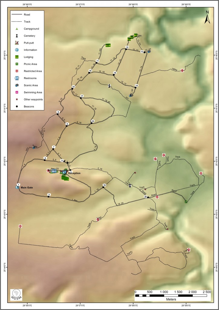
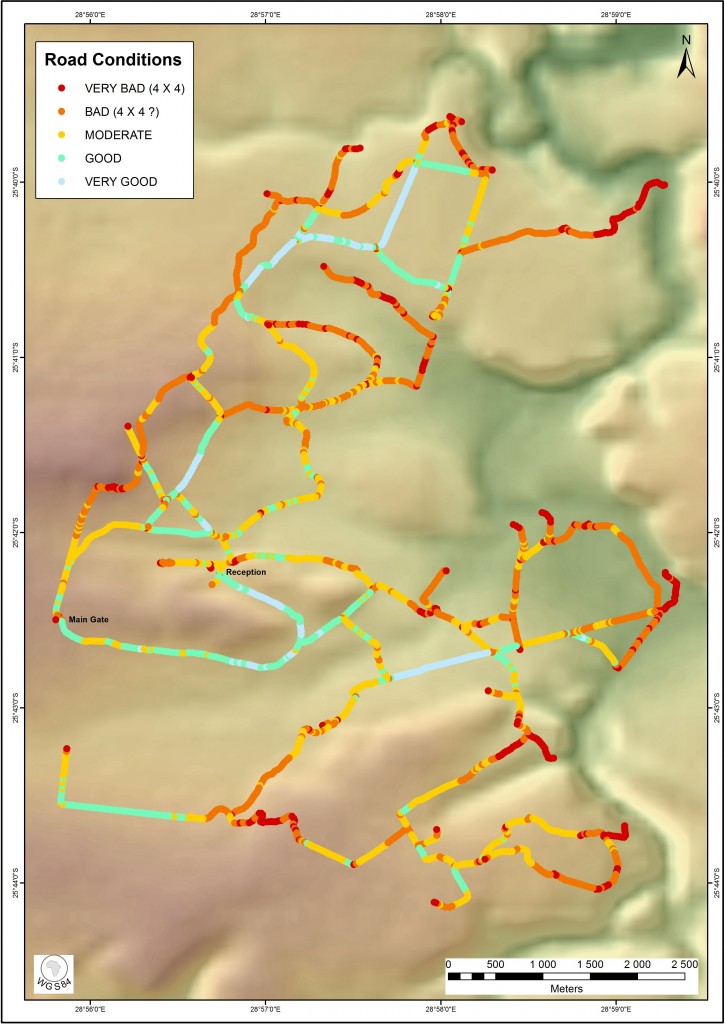
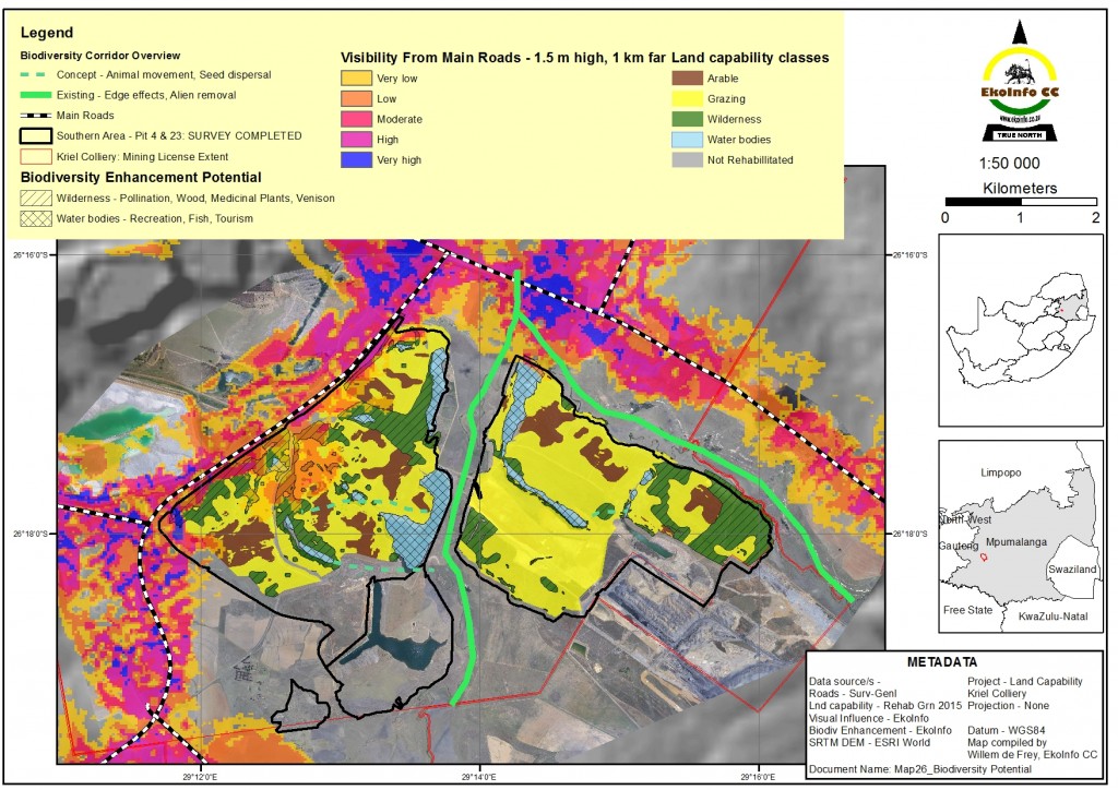
EkoInfo CC compiles maps of natural features from either hard copies or in digital format, using GIS software. The use of GIS software enables us to compile a series of thematic maps based on the information available.
Using vector and raster-based Geographic Information System (GIS) software, EkoInfo compiles maps from aerial photographs, satellite imagery, and available or newly captured natural resource data. The GIS software we use is ArcInfo and ArcView, both from ESRI and Idrisi Kilimanjaro from Clark Labs. These products are capable of importing or exporting digital information in a variety of formats. EkoInfo can, on request, print the maps from A4 to A0 either in-house or with printing services.
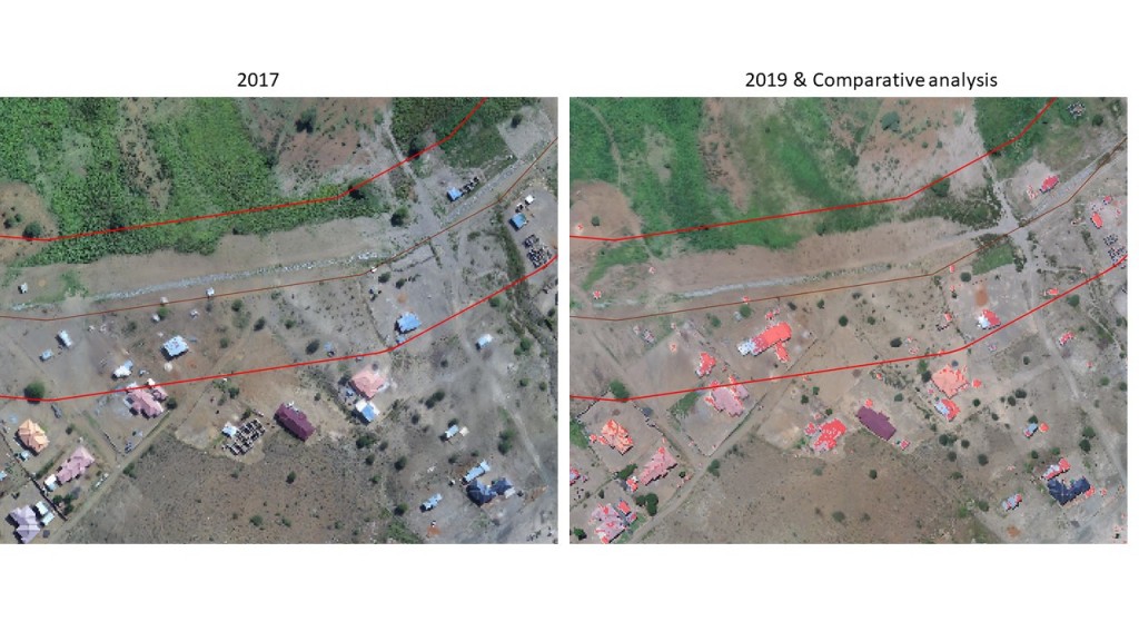
For projects that require monitoring, scientifically recognised quantitative or qualitative methods are applied in conjunction with baseline surveys. The method will depend on the nature of the parameter(s) to be monitored.